For me, the mountains have always reminded me of home. Whether I’m hiking in Northern Spain or exploring the Alps in Switzerland, getting outdoors has always been a way for me to clear my mind and hit that much-needed reset button, no matter where I am.
As you could imagine, planning a trip to the mountains is my absolute favorite thing to do while I’m home in California. So naturally, when I planned a flight back at the end of August, a trip to Mammoth Lakes with my family was high on my list of priorities.
With a little research, we found one hike that was highly recommended by many hikers in the area. That hike was Big Pine Lakes. After just a single photo, it’s clear to see why this trail has gained so much traction over the past few months.
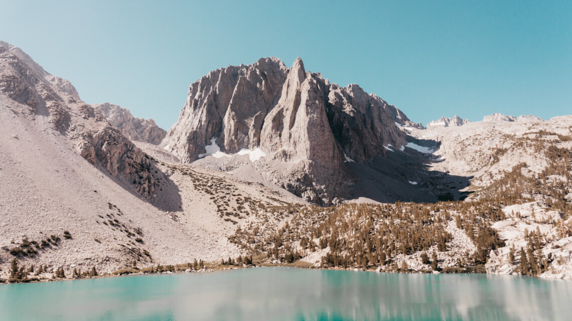
Big Pine Lakes showcases the very best of the Eastern Sierra mountain range. Waterfalls, streams, panoramic views of the surrounding mountains, and the most stunning lakes are all featured along this hike.
Whether you’re adapting your summer travel plans to stay local or you’re just looking to explore the great outdoors, the Big Pine Lake hike is one of the best spots in all of the Eastern Sierra mountain range – maybe even in California. With dramatic mountain landscapes and stunning turquoise waters, it’s no surprise why this trail has become a California hot spot.
Below I’ll be covering everything you need to know about hiking Big Pine Lakes in California!
Key Facts About Big Pine Lakes:
- Location: John Muir Wilderness in Inyo County
- Elevation gain: 2,297 feet
- Hiking Distance: 4.8 to First Lake, 5.75 to Third Lake
- Trailhead: Big Pine Creek Trailhead
- Difficulty Level: Moderate to Difficult
- Campsites: Big Pine Creek Campground and Sage Flat Campground
What to Know Before You Go:
Do You Need a Permit to Hike Big Pine Lakes?
If you are planning on doing a day hike to Big Pine Lakes, you do not need a permit. However, if you’re planning a backpacking trip, you will need to get a permit several months in advance. Spots are limited and are high in demand. If you are looking to do a backpacking trip in Big Pine Lakes, you can get your permit here.
Which Main Trail Do You Take?
The actual trail name for this hike is called Big Pine Creek Northfork Trail. You can find the trailhead at the road’s end of Big Pine Creek Campground. This stunning hike in the Inyo National Forest snakes through the John Muir Wilderness and offers stunning views of the Eastern Sierras.
When you begin the hike, you’ll see signs for both North Fork and South Fork trailheads. We followed the lower trail on the North Fork which offered a shadier path and a more gradual incline.
What Is the Best Time of Year to Hike Big Pine Lakes?
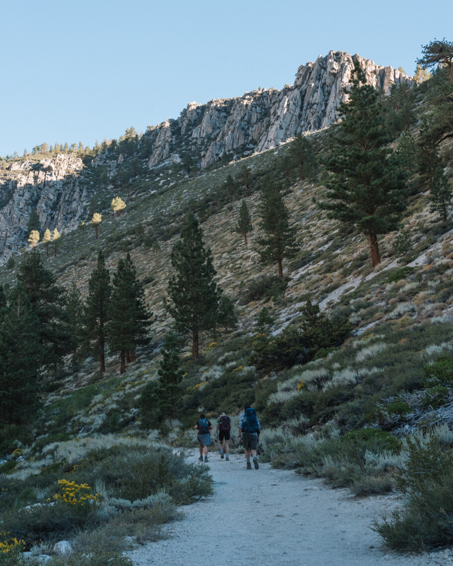
If you are heading to the Eastern Sierras to hike this trail, consider coming in late spring to early fall. The beginning and end of this trail are quite exposed, which means it can get very hot during the peak summer months.
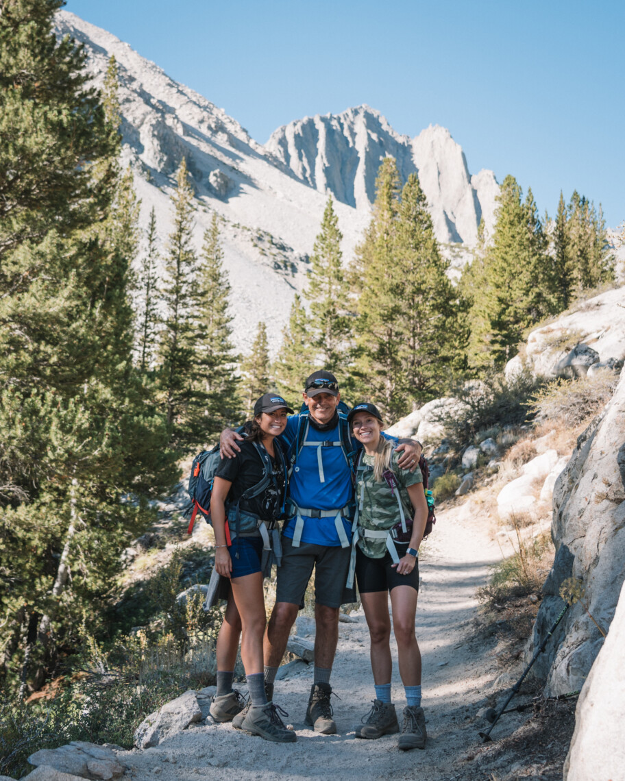
Regardless of when you decide to go, I highly consider starting as early as possible. We got on the trail at 7 am and had each lake to ourselves. Plus, we were able to do the more difficult climb during the cool morning hours which made the overall hike way more enjoyable.
Where to Stay When Hiking Big Pine Lakes
You have several options when deciding where to stay before hiking Big Pine Lakes. If you’re planning ahead, you can camp at one of the nearby campgrounds. Big Pine Creek Campground is the closest to the trailhead and is the best option in my opinion. We stayed on spot 19 which backed up to the river and was nice and secluded. Sage Flat Campground is another nearby option but it’s a bit further down the road. Keep in mind that you need a reservation for all campsites. To book a spot, check out this website.
If you don’t feel like camping, you can also stay in Bishop, which is about a 45-minute drive from the trailhead. Another option is Big Pine, however, both these towns have very few accommodation options. While Mammoth Lakes offers plenty of hotels and Airbnb’s, it will be about an hour and a half drive the morning of your hike.
Hiking Big Pine Lakes
The Big Pine Lakes hike consists of 7 different lakes and is 16.2 miles round trip. A shorter option is to hike to the third lake which is about 11 miles round trip. The distance between the first lake and the second lake is only a few minutes walking, and the third lake is another .6 miles each way. Since we started the hike at around 7 am, we were able to make it to the third lake by 11 am.
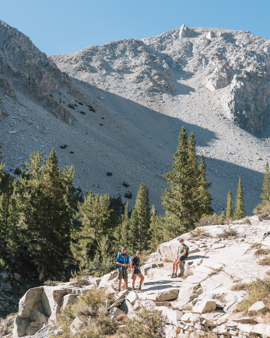
As I said before, the first part of the hike is the most difficult as it’s quite steep and completely exposed. The rocky switchbacks are where you’ll get most of your elevation gain, which is another reason why you should start as early as possible.
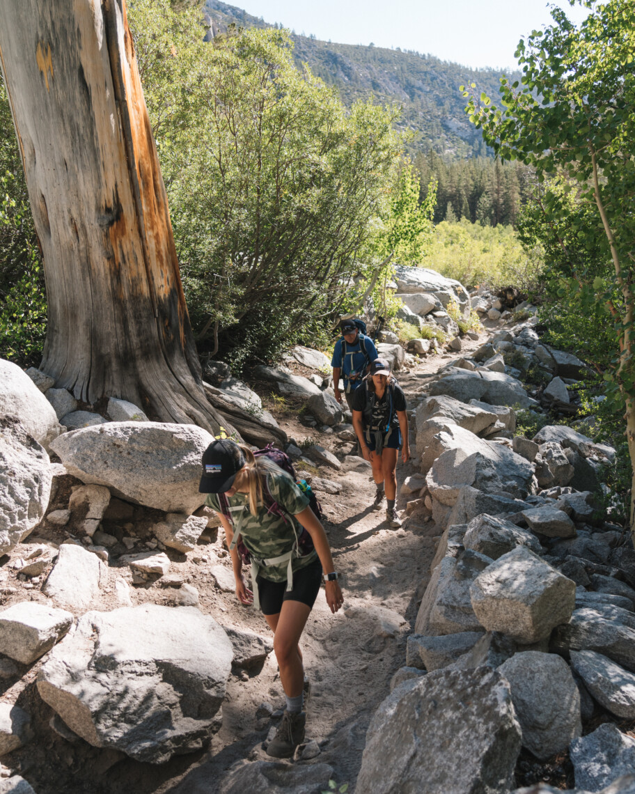
Once the main trail levels out, you’ll pass a roaring river and a few small waterfalls. At this point, you’ll begin to see tall pine trees and aspens lining the trail. For me, this was my favorite part of the Big Pine Lakes Hike (aside from the lakes themselves).
As you follow the path through shaded forest and breathtaking vistas, you’ll be able to hear the crashing river as it cascades into smaller pools and waterfalls. If you’re in need of a break, there are several spots where the river slows down and serves as an excellent spot for a quick morning dip.
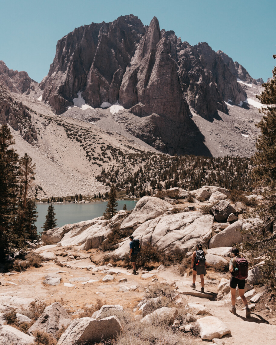
Once you get to the first lake, you’ll be able to find another trail that goes down to the water. If you are planning on going to the other two lakes, stay along the ridgeline and continue on. From there, all you’ll have to do is walk a few more minutes and you’ll reach the second lake.
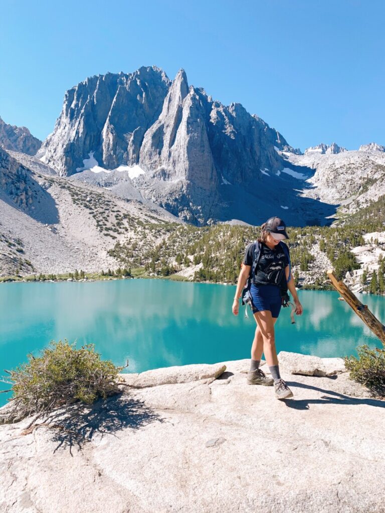
The second lake on the Big Pine Lakes hike is definitely the most famous, as it offers the most picturesque photo spot that overlooks turquoise blue waters and soaring stone cliffs. While there are great shaded spots that you can post up and eat lunch at, I suggest pushing through and heading to the third lake before stopping.
The third lake adds a little over a mile to your day, but it’s the least crowded and is completely worth it in my opinion. There are plenty of shaded spots right by the water to sit back, relax, and enjoy the scenery.
All in all, the first three lakes took us about 8 hours from start to finish with an hour lunch break in between. If you are planning on doing this hike, make sure to bring plenty of water and food, especially during the hot summer months.
Is the Hike Worth It?

If you are looking to break a sweat and get some quality time in nature, then this hike is definitely for you. From the very beginning, this trail offers incredible panoramas that give you a little bit of everything. Plus, the color of the lakes itself is deserving enough of the long trek.
So, grab your backpack, tie on those hiking boots, and get going! The climb is always worth it.
Also, thank you Keaton Browning for your incredible photos and video!
2 Comments
Keaton
September 16, 2020 at 8:36 amJust another mile… mile and a half. Awesome guide!
Dani Thomason
September 30, 2020 at 12:30 amhahahah classic! Thank you for all the amazing photos <3